 Loading...
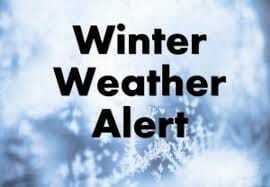
Below Zero Forecast Ahead
TUESDAY MORNING UPDATE:
The dangerous winter storm system that has been talked about for 2 weeks now is still on track to effect the region Thursday morning through Saturday morning.
Extreme cold, gusty winds, and blowing snow will make traveling difficult.
A Winter Storm Watch is in effect Thursday morning through Friday afternoon due to a widespread 2"-6" of snowfall excepted. The majority of the accumulating snowfall will occur in a few hours.
A Wind Chill Watch is in effect Thursday evening through Saturday midday due to the 30-50 mph winds expected. This will cause wind chill values to drop as low as 35 degrees BELOW ZERO.
Monday Morning Update: This very dangerous storm system is still on track to impact the United States the second half of the week into the holiday weekend. Impacts for northeast Missouri will occur early Thursday morning through Saturday morning. What to expect at this time...Thursday's high temperature will occur right after midnight in the upper 20s to low 30s. Temperatures will rapidly drop throughout the day into the low teens or upper single digits. Winds will increase ahead of the front. Snow will build into the region.
Winds 30-50 mph are currently expected causing morning wind chills Friday and Saturday morning to range from 15 to 30 degrees BELOW ZERO. Widespread snowfall is expected. With the setup I am looking at right now there will be a range of 3"-6"+ across the region. This forecast could change as more data becomes available over the next 48 hours.
PREPARE NOW! Home prepared for power outage. Car prepared for being stranded on roadside. It will be better to be over prepared.
Source: Northeast Missouri Weather Updates
Please support The Monroe County Appeal & Ralls County Herald-Enterprise by subscribing today!
.png)

